RidgeTop Aerial Technologies
RidgeTop Aerial Roof Diagram Ordering Form
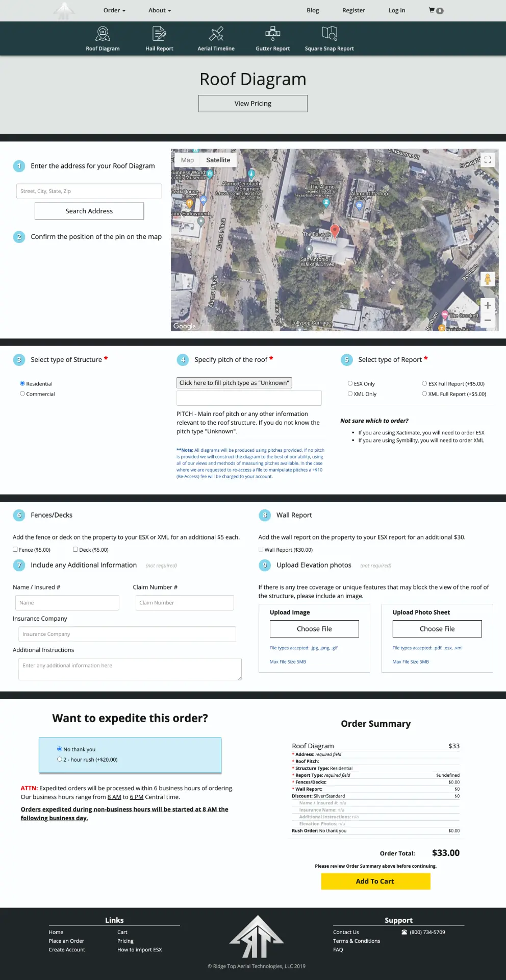
A long-form ordering interface for roof diagram reports that integrates Google Maps, geocoding, and real-time jQuery-driven updates so users can pin a property, configure report options, and review an itemized total before submitting.
What I contributed
- Built the responsive ordering form that connects address search to an interactive Google Map.
- Implemented geocoding so the map re-centers when an address is searched, and allowed users to fine-tune the pin to mark the exact roof needing a diagram.
- Used jQuery to update the itemized order summary in real time as the user selects structure type, roof pitch, report type, fences/decks, wall reports, and add-ons.
- Designed the summary section to give users a persistent overview of their selections and the ability to scroll back up and edit choices, especially on smaller screens.
- Handled form validation and progressive disclosure across a multi-section layout.
Context
While working for Allcat Claims, I built this ordering form for RidgeTop Aerial Technologies. Insurance and roofing customers needed a way to order roof diagram reports online, but the form had to collect a lot of detail — address verification, roof pitch, structure type, report format, add-ons, and more — without feeling overwhelming.
Approach
The form is built around a live Google Map. A user searches an address, the map updates via Google Geocoding, and the pin can be dragged to mark the exact roof. jQuery drives real-time updates to the itemized summary at the bottom, so every selection is reflected immediately in the order total. Because the form is long and detailed, the summary also acts as a wayfinding tool: users can review their choices and scroll back up to edit anything before submitting.
Outcome
The result is a single-page ordering experience that keeps complex configuration manageable. Users can verify the location visually, adjust the pin for accuracy, and see a clear breakdown of costs before adding the report to their cart.
Note on contribution
Developed while employed at Allcat Claims for RidgeTop Aerial Technologies. I built the front-end form, integrated Google Maps and Geocoding, and implemented the real-time summary logic. Branding and report fulfillment were handled by RidgeTop Aerial Technologies.
Gallery